
1970 Map of Mocane SE
USGS Topo · Published 1973About this map
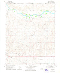
The meandering course of the Beaver River dominates this Panhandle landscape, carving through a region defined by early energy development and agricultural boundaries. Surveyed in 1969, the map reveals a high density of gas wells and complex pipelines that speak to the industrial character of the Oklahoma plains during this era. The terrain is further shaped by several drainage systems, including Spring Creek, Duck Pond Creek, and Camp Creek, which feed into the primary river valley. Scattered industrial markers like a Gravel Pit indicate local resource extraction, while the distinct township sections of Knowles and Benton provide a clear grid of human organization and land ownership. This survey is particularly notable for its inclusion of fine red dashed lines that represent selected fence and field lines as they appeared from aerial photography, offering genealogists and land researchers a specific look at property divisions and rural land use.
Find a feature on this map
11 named features on this map. Tap any name to fly to it.
Don’t see what you’re looking for? This feature index may not catch every label — zoom into the map to look around manually.
Map Details
Editions of this 1970 Mocane SE Map
This is the sole edition of this map. No revisions or reprints were ever made.
Other maps of this area

1954 · Perryton
USGS Topo · 1:250,000

1958 · Perryton
USGS Topo · 1:250,000

1970 · Knowles
USGS Topo · 1:24,000

1970 · Gate NW
USGS Topo · 1:24,000

1970 · Mocane NW
USGS Topo · 1:24,000
1970 · Mocane
USGS Topo · 1:24,000

1971 · Clear Lake NW
USGS Topo · 1:24,000

1971 · Clear Lake
USGS Topo · 1:24,000

1971 · Logan NW
USGS Topo · 1:24,000
1971 · Mocane SW
USGS Topo · 1:24,000