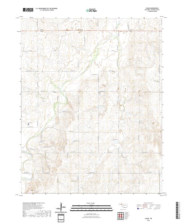
2022 Map of Logan
USGS Topo · Published 2022About this map
Logan stands as the primary settlement in this corner of Beaver County, situated along the drainage of Kiowa Cr. The landscape is defined by its watercourses, where Don Jose Cr and Indian Cr carve through the high plains terrain. Significant landmarks for local history include the Kiowa Cem located to the west of the main settlement and the prominent Indian Hill rising in the southern portion of the quadrangle. The northern edge is dominated by the corridor of 270 412, a major east-west route through the Oklahoma Panhandle. This survey also documents local water management through features like the Jett Number 3 Reservoir, which provides insight into the agricultural and ranching infrastructure of this arid region.
Find a feature on this map
53 named features on this map. Tap any name to fly to it.
Don’t see what you’re looking for? This feature index may not catch every label — zoom into the map to look around manually.
Map Details
Editions of this 2022 Logan Map
This is the sole edition of this map. No revisions or reprints were ever made.
Other maps of this area

1954 · Perryton
USGS Topo · 1:250,000

1958 · Perryton
USGS Topo · 1:250,000

1971 · Clear Lake
USGS Topo · 1:24,000

1971 · Clear Lake SE
USGS Topo · 1:24,000

1971 · Logan
USGS Topo · 1:24,000

1971 · Logan NW
USGS Topo · 1:24,000

1971 · Logan NE
USGS Topo · 1:24,000

1971 · Slapout
USGS Topo · 1:24,000
1972 · Magoun
USGS Topo · 1:24,000

1972 · Follett
USGS Topo · 1:24,000