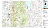
1984 Map of Logan
USGS Topo · Published 1985About this map
Cache Valley serves as the central hub of this mid-1980s landscape, where a dense corridor of settlements like Logan, Smithfield, and Wellsville sits between the Wellsville Mountains and the high Bear River Range. The map illustrates a complex water system managed through the Cutler Reservoir and the Little Bear River, supporting the agricultural and civic life of northern Utah. To the east, the dramatic elevation change leads into the Cache National Forest, eventually descending toward the western shores of Bear Lake.
Find a feature on this map
92 named features on this map. Tap any name to fly to it.
Don’t see what you’re looking for? This feature index may not catch every label — zoom into the map to look around manually.
Map Details
Editions of this 1984 Logan Map
3 editions found
Other maps of this area

1909 · Montpelier
USGS Topo · 1:125,000

1911 · Montpelier
USGS Topo · 1:125,000

1912 · Randolph
USGS Topo · 1:125,000

1914 · Logan
USGS Topo · 1:125,000

1915 · Preston
USGS Topo · 1:96,000

1916 · Logan
USGS Topo · 1:125,000

1918 · Preston
USGS Topo · 1:125,000

1936 · Cokeville
USGS Topo · 1:96,000

1942 · Cokeville
USGS Topo · 1:125,000

1949 · Boulter Mts
USGS Topo · 1:24,000