Loading...
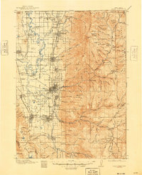
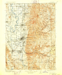
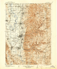
Loading map...1916 Map of Logan
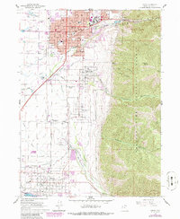
USGS Topo · Published 1948About this map
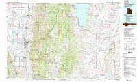
Logan serves as the hub of a thriving agricultural and industrial valley in this early twentieth-century survey, flanked by the high peaks of the Cache National Forest. The landscape reveals a complex network of irrigation and transportation, where the Bear River and Cub River feed into a grid of canals and rail lines, including the Oregon Short Line and Cache Valley RR. Industrial footprints are clearly visible, notably the Sugar Factory south of the city and the Valley Mill near Richmond.
Find a feature on this map
181 named features on this map. Tap any name to fly to it.
Don’t see what you’re looking for? This feature index may not catch every label — zoom into the map to look around manually.
Map Details
Date Portrayed1916
Date Published1948
PublisherU.S. Geological Survey
Map TypeTopographic
Scale1:125,000
Physical Dimensions17 x 20.7 inches
Editions of this 1916 Logan Map
4 editions found

Historical Maps of Logan Through Time
6 maps found

Featured Locations
Source Details
SourceU.S. Geological Survey
CopyrightPublic Domain