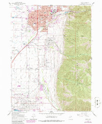
1916 Map of Logan
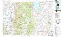
USGS Topo · Published 1928About this map
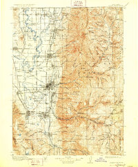
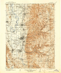
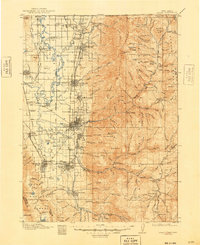
Logan serves as the focal point of this Cache Valley survey, where the agricultural industry of the early twentieth century is clearly marked by the prominent Sugar Factory and specialized rail connections like Sugar Spur and College Spur. The industrial footprint of the Oregon Short Line railroad ties together a string of agricultural settlements including Wellsville, Hyrum, and Smithfield, while the eastern portion of the sheet rises sharply into the Cache National Forest. In the high country, resource extraction and recreation coexist, evidenced by the Amazon Mine and Lucky Star Mine tucked into deep canyons like Smithfield Canyon and Providence Canyon. Local education and postal history are well-preserved through numerous small landmarks such as Sterling School, Wheeler School, and the Manton Geneva P.O. at the southern edge of the survey.
Find a feature on this map
159 named features on this map. Tap any name to fly to it.
Don’t see what you’re looking for? This feature index may not catch every label — zoom into the map to look around manually.
Map Details
Editions of this 1916 Logan Map
4 editions found

Historical Maps of Logan Through Time
6 maps found