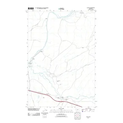
2011 Map of Logan
USGS Topo · Published 2011About this map
The confluence of the Missouri River and Gallatin River dominates this landscape, where the headwaters of the Missouri begin. Near the water's edge, Missouri Headwaters Campground and Headwaters Cemetery provide physical links to the early exploration and settlement of the region. The transport infrastructure reflects a layered history, with the Northern Pacific Railroad Bridge and Trident Bridge crossing the major waterways. Further south, the town of Logan serves as a local hub, situated near the Logan Cemetery and the Logan Bridge. The layout of the region is defined by these prominent river valleys and the deep incisions of Big Davis Gulch and Cottonwood Gulch. Smaller settlements like Trident, Eustis, and Carpenter are connected by a network of local routes such as Camp Spring Rd and Old Town Rd, tracing the paths of agricultural and industrial development.
Find a feature on this map
32 named features on this map. Tap any name to fly to it.
Don’t see what you’re looking for? This feature index may not catch every label — zoom into the map to look around manually.
Map Details
Editions of this 2011 Logan Map
This is the sole edition of this map. No revisions or reprints were ever made.
Other maps of this area

1886 · Fort Logan
USGS Topo · 1:250,000

1888 · Three Forks
USGS Topo · 1:250,000

1894 · Three Forks
USGS Topo · 1:250,000

1895 · Three Forks
USGS Topo · 1:250,000

1947 · Bozeman
USGS Topo · 1:250,000

1948 · Bozeman
USGS Topo · 1:250,000

1948 · White Sulphur Springs
USGS Topo · 1:250,000

1949 · Radersburg
USGS Topo · 1:62,500

1949 · Manhattan
USGS Topo · 1:62,500

1949 · Toston
USGS Topo · 1:62,500