
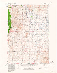
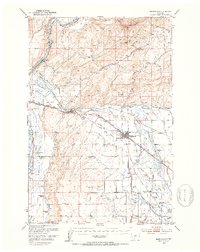
1949 Map of Radersburg
USGS Topo · Published 1953About this map
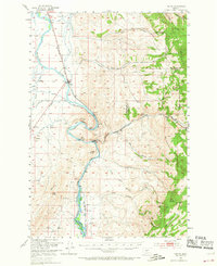
Radersburg sits at the heart of this post-war landscape, where the high-elevation mining district of the Helena National Forest meets the irrigated agricultural valley of Crow Creek. Gold and silver mining heritage is evident throughout the western hills, featuring numerous operations such as the Montana Silver Star Mine, Black Friday Mines, and Dandy Mine. While many sites are marked as inactive, the Ruby Mine (Active) and Nada Mine (Active) highlight continued mineral production into the late 1940s.
Find a feature on this map
44 named features on this map. Tap any name to fly to it.
Don’t see what you’re looking for? This feature index may not catch every label — zoom into the map to look around manually.
Map Details
Editions of this 1949 Radersburg Map
5 editions found
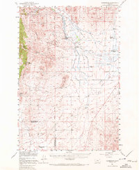
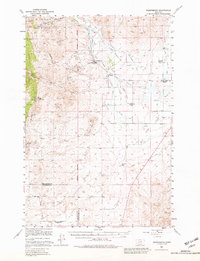
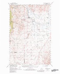
Other maps of this area

1886 · Fort Logan
USGS Topo · 1:250,000

1888 · Three Forks
USGS Topo · 1:250,000

1894 · Three Forks
USGS Topo · 1:250,000

1895 · Three Forks
USGS Topo · 1:250,000

1947 · Bozeman
USGS Topo · 1:250,000

1948 · Bozeman
USGS Topo · 1:250,000

1948 · White Sulphur Springs
USGS Topo · 1:250,000
1949 · Manhattan
USGS Topo · 1:62,500
1949 · Toston
USGS Topo · 1:62,500
1950 · Devils Fence
USGS Topo · 1:62,500