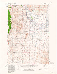
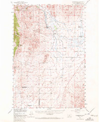
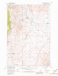
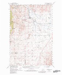
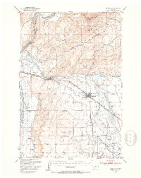
1949 Map of Radersburg
USGS Topo · Published 1963About this map
Radersburg serves as the focal point of this late 1940s landscape, where the transition from high mountain mining to valley floor agriculture is clearly documented. The western highlands, dominated by the Helena National Forest and Elkhorn Mountain, are heavily marked by historic mineral extraction, including the Keating Mines, Black Friday Mines, and Rails Mines. These workings follow deep incisions like Keating Gulch and Johnny Gulch, leading down toward the plains.
Find a feature on this map
43 named features on this map. Tap any name to fly to it.
Don’t see what you’re looking for? This feature index may not catch every label — zoom into the map to look around manually.
Map Details
Editions of this 1949 Radersburg Map
5 editions found
Other maps of this area

1886 · Fort Logan
USGS Topo · 1:250,000

1888 · Three Forks
USGS Topo · 1:250,000

1894 · Three Forks
USGS Topo · 1:250,000

1895 · Three Forks
USGS Topo · 1:250,000

1947 · Bozeman
USGS Topo · 1:250,000

1948 · Bozeman
USGS Topo · 1:250,000

1948 · White Sulphur Springs
USGS Topo · 1:250,000

1949 · Radersburg
USGS Topo · 1:62,500
1949 · Manhattan
USGS Topo · 1:62,500
1949 · Toston
USGS Topo · 1:62,500