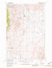
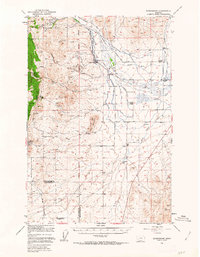
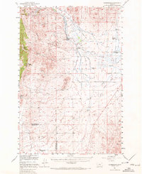
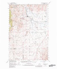
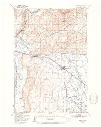
1949 Map of Radersburg
USGS Topo · Published 1982About this map
Radersburg serves as the central hub of this high-country landscape, where mining activity defines the eastern slopes of the Helena National Forest. The map documents a significant density of hard-rock mining operations including the Keating Mines, Ohio Mines, and the Black Friday Mines. This mineral-driven economy is further evidenced by smaller prospects like the Slim Sam Mine and the San Anita Mine scattered through the gulches.
Find a feature on this map
29 named features on this map. Tap any name to fly to it.
Don’t see what you’re looking for? This feature index may not catch every label — zoom into the map to look around manually.
Map Details
Editions of this 1949 Radersburg Map
5 editions found
Other maps of this area

1886 · Fort Logan
USGS Topo · 1:250,000

1888 · Three Forks
USGS Topo · 1:250,000

1894 · Three Forks
USGS Topo · 1:250,000

1895 · Three Forks
USGS Topo · 1:250,000

1947 · Bozeman
USGS Topo · 1:250,000

1948 · Bozeman
USGS Topo · 1:250,000

1948 · White Sulphur Springs
USGS Topo · 1:250,000

1949 · Radersburg
USGS Topo · 1:62,500
1949 · Manhattan
USGS Topo · 1:62,500
1949 · Toston
USGS Topo · 1:62,500