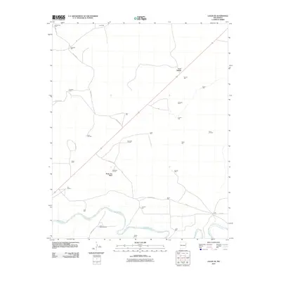
2010 Map of Logan NE
USGS Topo · Published 2010About this map
The Canadian River meanders through the southern portion of this high plains landscape, defining the primary drainage for a region dominated by ranching and water resource management. Distributed across the terrain are several established homesteads and operations, including Sand Springs Ranch, Rodewald Ranch, and Pyle Ranch, which serve as the anchors for local activity. The presence of numerous named water sources like South Well, Garrison Well, and Chalk Well underscores the critical importance of groundwater for sustaining the livestock industry in this arid environment.
Find a feature on this map
37 named features on this map. Tap any name to fly to it.
Don’t see what you’re looking for? This feature index may not catch every label — zoom into the map to look around manually.
Map Details
Editions of this 2010 Logan NE Map
This is the sole edition of this map. No revisions or reprints were ever made.
Other maps of this area

1954 · Tucumcari
USGS Topo · 1:250,000

1958 · Tucumcari
USGS Topo · 1:250,000

1962 · Logan
USGS Topo · 1:62,500

1966 · Lockney
USGS Topo · 1:24,000

1966 · Mc Carty Ranch
USGS Topo · 1:24,000

1968 · Blue Hole
USGS Topo · 1:24,000

1968 · Cammak Camp
USGS Topo · 1:24,000

1971 · Obar
USGS Topo · 1:24,000
1989 · Tuscocoillo Canyon
USGS Topo · 1:24,000
1989 · Logan South
USGS Topo · 1:24,000