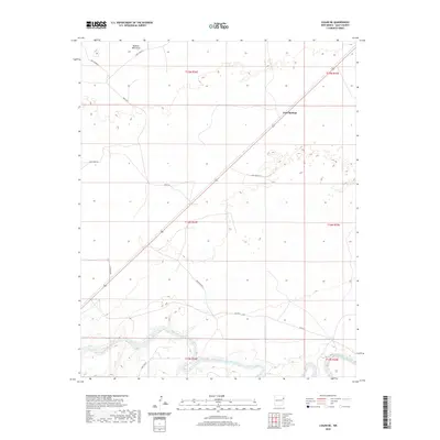
2020 Map of Logan NE
USGS Topo · Published 2020About this map
The Canadian River winds through the southern portion of this high plains landscape, defining the local topography as it cuts through the arid terrain of northeastern New Mexico. This 2020 survey illustrates a sparsely populated region of Quay County where the land is primarily organized by a grid of rural routes such as Quay Road 85 and Quay Road R.
Find a feature on this map
17 named features on this map. Tap any name to fly to it.
Don’t see what you’re looking for? This feature index may not catch every label — zoom into the map to look around manually.
Map Details
Editions of this 2020 Logan NE Map
This is the sole edition of this map. No revisions or reprints were ever made.
Other maps of this area

1954 · Tucumcari
USGS Topo · 1:250,000

1958 · Tucumcari
USGS Topo · 1:250,000

1962 · Logan
USGS Topo · 1:62,500

1966 · Lockney
USGS Topo · 1:24,000

1966 · Mc Carty Ranch
USGS Topo · 1:24,000

1968 · Blue Hole
USGS Topo · 1:24,000

1968 · Cammak Camp
USGS Topo · 1:24,000

1971 · Obar
USGS Topo · 1:24,000
1989 · Tuscocoillo Canyon
USGS Topo · 1:24,000
1989 · Logan South
USGS Topo · 1:24,000