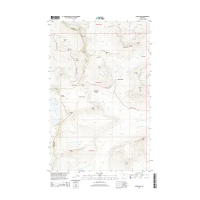
2014 Map of Logan Pass
USGS Topo · Published 2014About this map
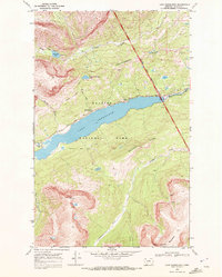
Glacier National Park reveals its high-altitude character along the Continental Divide in this survey of the Logan Pass area. The topographic detail highlights the serpentine path of the Going-to-the-Sun Rd, a feat of engineering that passes the Triple Arches and the Weeping Wall before reaching the summit. The landscape is defined by its namesake ice features, including the Grinnell Glacier, Sperry Glacier, and the smaller Sexton Glacier, many of which feed the alpine hydrology of the Saint Mary River. The physical geography is dominated by the massive ridge of The Garden Wall, which separates the drainages of Cataract Cr and Logan Cr. Prominent peaks like Mt Gould and Reynolds Mtn provide context for the dramatic elevation changes that characterize this protected wilderness, while lower points such as Mirror Pond and Gunsight Lake sit within deep glacial basins.
Find a feature on this map
59 named features on this map. Tap any name to fly to it.
Don’t see what you’re looking for? This feature index may not catch every label — zoom into the map to look around manually.
Map Details
Editions of this 2014 Logan Pass Map
This is the sole edition of this map. No revisions or reprints were ever made.
Other maps of this area

1904 · Chief Mountain
USGS Topo · 1:125,000

1938 · Chief Mountain
USGS Topo · 1:125,000

1960 · Cut Bank
USGS Topo · 1:250,000

1963 · Cut Bank
USGS Topo · 1:250,000

1964 · Cut Bank
USGS Topo · 1:250,000

1968 · Ahern Pass
USGS Topo · 1:24,000
1968 · Mount Cannon
USGS Topo · 1:24,000
1968 · Logan Pass
USGS Topo · 1:24,000
1968 · Rising Sun
USGS Topo · 1:24,000
1968 · Lake Sherburne
USGS Topo · 1:24,000