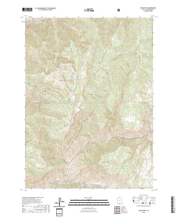
2023 Map of Logan Peak
USGS Topo · Published 2023About this map
The Bear River Range dominates this portion of the Cache National Forest, defining a high-altitude landscape of steep canyons and prominent summits. Rising above the terrain, Logan Peak, Providence Peak, and Millville Peak form a jagged north-south spine that overlooks the valleys to the west. The drainage network is complex, with Providence Canyon and Millville Canyon carving deep paths through the mountains, while more secluded features like Second Waterfall Hollow and Cave Hollow reflect the area’s rugged hydrology.
Find a feature on this map
57 named features on this map. Tap any name to fly to it.
Don’t see what you’re looking for? This feature index may not catch every label — zoom into the map to look around manually.
Map Details
Editions of this 2023 Logan Peak Map
This is the sole edition of this map. No revisions or reprints were ever made.
Other maps of this area

1914 · Logan
USGS Topo · 1:125,000

1916 · Logan
USGS Topo · 1:125,000

1949 · Boulter Mts
USGS Topo · 1:24,000

1954 · Ogden
USGS Topo · 1:250,000

1955 · Paradise
USGS Topo · 1:24,000

1958 · Ogden
USGS Topo · 1:250,000

1960 · Ogden
USGS Topo · 1:250,000

1961 · Logan
USGS Topo · 1:24,000
1964 · Smithfield
USGS Topo · 1:24,000

1969 · Boulder Mtn
USGS Topo · 1:24,000