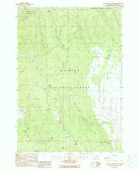
1988 Map of Logan Valley West
USGS Topo · Published 1988About this map
The Strawberry Mountain Range dominates the northern reaches of this landscape, overlooking the broad expanse of Logan Valley to the southeast. Within the Malheur National Forest, the terrain is defined by a network of high-elevation meadows and named water sources like Dago Spring and Tony Spring. The presence of an Old RR Grade cutting through the center of the map provides a tangible link to the area's historical timber or resource extraction activities, showing where rail lines once navigated the slopes above Crooked Meadows Creek. Recreation and forestry management are evident through the established Murray Campground and the Lake Creek Organization Camp located along the eastern edge of the survey. The transition from the protected Strawberry Mountain Wilderness into the valley floor illustrates the diverse land use of this region in Grant County.
Find a feature on this map
34 named features on this map. Tap any name to fly to it.
Don’t see what you’re looking for? This feature index may not catch every label — zoom into the map to look around manually.
Map Details
Editions of this 1988 Logan Valley West Map
This is the sole edition of this map. No revisions or reprints were ever made.
Other maps of this area

1940 · John Day
USGS Topo · 1:62,500

1943 · John Day
USGS Topo · 1:62,500

1955 · Canyon City
USGS Topo · 1:250,000

1959 · Canyon City
USGS Topo · 1:250,000

1959 · Prairie City
USGS Topo · 1:62,500

1961 · Logan Valley
USGS Topo · 1:62,500

1961 · Seneca
USGS Topo · 1:62,500
1972 · Pine Creek Mtn
USGS Topo · 1:24,000

1978 · John Day
USGS Topo · 1:100,000
1988 · Logan Valley East
USGS Topo · 1:24,000