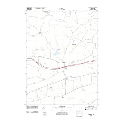
2010 Map of Loganton
USGS Topo · Published 2010About this map
Loganton serves as a central hub in this valley landscape, where the waters of Fishing Creek and Mill Creek converge. The area is defined by a series of small, established settlements like Schracktown, Booneville, and Greenburr that follow the creek beds and mountain gaps. For those tracing local heritage, the map identifies specific burial grounds including Fairview Cemetery and the Old Schracktown Cemetery near Blue Spring.
Find a feature on this map
78 named features on this map. Tap any name to fly to it.
Don’t see what you’re looking for? This feature index may not catch every label — zoom into the map to look around manually.
Map Details
Editions of this 2010 Loganton Map
This is the sole edition of this map. No revisions or reprints were ever made.
Other maps of this area

1921 · Williamsport
USGS Topo · 1:48,000

1921 · Lock Haven
USGS Topo · 1:62,500

1923 · Lock Haven
USGS Topo · 1:62,500

1923 · Williamsport
USGS Topo · 1:62,500

1937 · Millheim
USGS Topo · 1:48,000

1938 · Mifflinburg
USGS Topo · 1:48,000

1941 · Millheim
USGS Topo · 1:62,500

1943 · Mifflinburg
USGS Topo · 1:62,500

1944 · Williamsport
USGS Topo · 1:62,500

1944 · Lock Haven
USGS Topo · 1:62,500
Featured Places
- Wayne Township, PA
- Rosecrans, Greene Township
- Schracktown, Greene Township
- Loganton, PA
- Crawford Township, PA