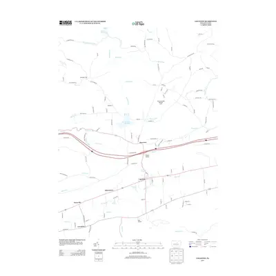
2013 Map of Loganton
USGS Topo · Published 2013About this map
Fishing Cr winds through the Sugar Valley in southern Clinton County, anchoring a string of historic agricultural settlements including Loganton, Schracktown, Booneville, and Greenburr. This 2013 survey illustrates the corridor of modern Interstate 80 as it traverses the terrain near Rosecrans, separating the developed valley floor from the forested uplands of Nittany Ridge. The landscape is defined by its water resources, from the natural Sulphur Spring and Blue Spring to the engineered Warren H Ohl Reservoir and Keller Reservoir.
Find a feature on this map
109 named features on this map. Tap any name to fly to it.
Don’t see what you’re looking for? This feature index may not catch every label — zoom into the map to look around manually.
Map Details
Editions of this 2013 Loganton Map
This is the sole edition of this map. No revisions or reprints were ever made.
Other maps of this area

1921 · Williamsport
USGS Topo · 1:48,000

1921 · Lock Haven
USGS Topo · 1:62,500

1923 · Lock Haven
USGS Topo · 1:62,500

1923 · Williamsport
USGS Topo · 1:62,500

1937 · Millheim
USGS Topo · 1:48,000

1938 · Mifflinburg
USGS Topo · 1:48,000

1941 · Millheim
USGS Topo · 1:62,500

1943 · Mifflinburg
USGS Topo · 1:62,500

1944 · Williamsport
USGS Topo · 1:62,500

1944 · Lock Haven
USGS Topo · 1:62,500
Featured Places
- Wayne Township, PA
- Rosecrans, Greene Township
- Schracktown, Greene Township
- Loganton, PA
- Crawford Township, PA