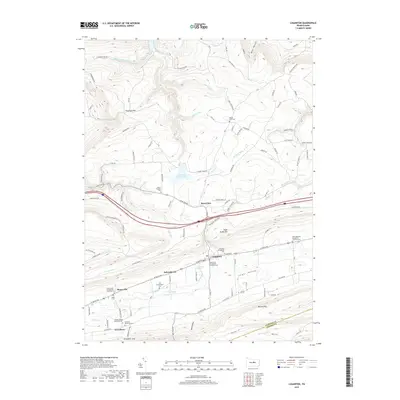
2019 Map of Loganton
USGS Topo · Published 2019About this map
Sugar Valley forms the central character of this Clinton County landscape, where the borough of Loganton serves as a primary hub. The valley floor is marked by a distinctive chain of historical settlements including Schracktown, Booneville, and Greenburr, each anchored by foundational community spaces. Local history and genealogy researchers will find an exceptional density of burial grounds, such as Saint Johns Evangelical Lutheran Cem and Trinity United Methodist Cem, which reflect the area's deep religious heritage. The surrounding topography is defined by the high ridges of Sugar Valley Mtn and Nittany Mtn, while the water system is anchored by the Warren H Ohl Reservoir and the winding course of Fishing Cr. This geography created a naturally enclosed community where mountain gaps like Greenburr Gap provided essential passage to the world beyond the valley walls.
Find a feature on this map
122 named features on this map. Tap any name to fly to it.
Don’t see what you’re looking for? This feature index may not catch every label — zoom into the map to look around manually.
Map Details
Editions of this 2019 Loganton Map
This is the sole edition of this map. No revisions or reprints were ever made.
Other maps of this area

1921 · Williamsport
USGS Topo · 1:48,000

1921 · Lock Haven
USGS Topo · 1:62,500

1923 · Lock Haven
USGS Topo · 1:62,500

1923 · Williamsport
USGS Topo · 1:62,500

1937 · Millheim
USGS Topo · 1:48,000

1938 · Mifflinburg
USGS Topo · 1:48,000

1941 · Millheim
USGS Topo · 1:62,500

1943 · Mifflinburg
USGS Topo · 1:62,500

1944 · Williamsport
USGS Topo · 1:62,500

1944 · Lock Haven
USGS Topo · 1:62,500
Featured Places
- Wayne Township, PA
- Rosecrans, Greene Township
- Schracktown, Greene Township
- Loganton, PA
- Crawford Township, PA