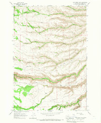
1965 Map of Logy Creek Falls
USGS Topo · Published 1966About this map
Logy Creek Falls marks a dramatic point in the southern Yakima landscape, where the waters of Logy Creek drop through the steep terrain of Logy Canyon. This mid-1960s survey illustrates a region defined by its complex drainage network and high-elevation grazing lands. The vast Tannawasha Pasture dominates the lower third of the quadrangle, punctuated by essential water sources like Bergie Springs and the headwaters of Black Rock Creek.
Find a feature on this map
17 named features on this map. Tap any name to fly to it.
Don’t see what you’re looking for? This feature index may not catch every label — zoom into the map to look around manually.
Map Details
Editions of this 1965 Logy Creek Falls Map
2 editions found
Other maps of this area

1937 · White Swan
USGS Topo · 1:125,000

1950 · Yakima
USGS Topo · 1:250,000

1958 · Toppenish Mtn.
USGS Topo · 1:24,000

1958 · Fort Simcoe
USGS Topo · 1:24,000

1958 · Fort Simcoe
USGS Topo · 1:62,500

1958 · Harrah SE
USGS Topo · 1:24,000

1958 · Yakima
USGS Topo · 1:250,000

1961 · Yakima
USGS Topo · 1:250,000
1965 · Kusshi Creek
USGS Topo · 1:24,000
1965 · Logy Creek
USGS Topo · 1:62,500