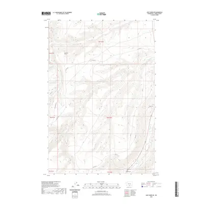
2020 Map of Logy Creek NE
USGS Topo · Published 2020About this map
Satus Cr flows through this corner of Yakima County, carving a path alongside Lizzy Canyon in a landscape defined by an intricate network of seasonal drainages and creek beds. The map documents a sparsely settled region within the Yakima Indian Reservation, where Bureau of Indian Affairs roads such as Bia RD 172 and Bia RD 216 provide the primary access to the upland plateaus. Significant local landmarks include the distinct bend of Dry Creek Elbow and the primary watercourse of Logy Cr, which gathers tributaries like Knockout Cr and Fortyday Cr. For the genealogist and local historian, the presence of the Sampson Cem and Toweatmy Cem offers critical points of reference for tracing family lineages and heritage in this rural expanse.
Find a feature on this map
23 named features on this map. Tap any name to fly to it.
Don’t see what you’re looking for? This feature index may not catch every label — zoom into the map to look around manually.
Map Details
Editions of this 2020 Logy Creek NE Map
This is the sole edition of this map. No revisions or reprints were ever made.
Other maps of this area

1910 · Zillah
USGS Topo · 1:125,000

1937 · White Swan
USGS Topo · 1:125,000

1950 · Yakima
USGS Topo · 1:250,000

1958 · Toppenish SW
USGS Topo · 1:24,000

1958 · Toppenish Mtn.
USGS Topo · 1:24,000

1958 · Harrah SE
USGS Topo · 1:24,000

1958 · Yakima
USGS Topo · 1:250,000

1961 · Yakima
USGS Topo · 1:250,000
1965 · Kusshi Creek
USGS Topo · 1:24,000
1965 · Logy Creek
USGS Topo · 1:62,500