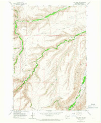
1965 Map of Logy Creek NE
USGS Topo · Published 1967About this map
Logy Creek and its complex system of tributaries carve through this high-elevation territory in the Yakima region, defining a landscape of deep canyons and seasonal drainages. The 1960s terrain is marked by isolated landmarks that suggest a reliance on small-scale aviation and livestock management, most notably the Landing Strip situated on a high plateau. Water sources are critical here, evidenced by the numerous named flows like Dry Creek, Spring Creek, and Lizzy Spring Canyon, many of which appear to follow structural folds in the earth such as the prominent bend known as the Elbow. Local history is anchored by the presence of the Towatmy Cem and Simpson Cem, which are linked by remote tracks like Cemetery Road. These features, along with a high-country Jeep Trail, provide evidence of established routes and familial sites within a topographic environment characterized by sharp elevation changes between creek beds and ridge lines.
Find a feature on this map
19 named features on this map. Tap any name to fly to it.
Don’t see what you’re looking for? This feature index may not catch every label — zoom into the map to look around manually.
Map Details
Editions of this 1965 Logy Creek NE Map
This is the sole edition of this map. No revisions or reprints were ever made.
Other maps of this area

1910 · Zillah
USGS Topo · 1:125,000

1937 · White Swan
USGS Topo · 1:125,000

1950 · Yakima
USGS Topo · 1:250,000

1958 · Toppenish SW
USGS Topo · 1:24,000

1958 · Toppenish Mtn.
USGS Topo · 1:24,000

1958 · Harrah SE
USGS Topo · 1:24,000

1958 · Yakima
USGS Topo · 1:250,000

1961 · Yakima
USGS Topo · 1:250,000
1965 · Kusshi Creek
USGS Topo · 1:24,000
1965 · Logy Creek
USGS Topo · 1:62,500