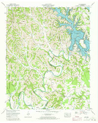
1972 Map of Lois
USGS Topo · Published 1973About this map
Tims Ford Lake dominates the eastern landscape of this Moore County survey, a reservoir created by the newly constructed Tims Ford Dam on the Elk River. The 1972 boundary revisions illustrate the transformation of the river valley, where formerly terrestrial landmarks like The Narrows and Wiseman Bend are now defined by rising waters. Away from the lake, the terrain transitions into the steep ridges of Possum Trot Ridge and Preston Ridge, where small rural communities like Lois and Brownington remain connected by winding country routes such as Anderson Road. Genealogists will find a high density of family burial grounds, including the Vanzant Cem, Tipps Cem, and Moorehead Cem, alongside local landmarks like Smith Chapel and Marble Plains Ch, offering a clear view of the settlement patterns established before the mid-century hydrological changes.
Find a feature on this map
119 named features on this map. Tap any name to fly to it.
Don’t see what you’re looking for? This feature index may not catch every label — zoom into the map to look around manually.
Map Details
Editions of this 1972 Lois Map
2 editions found
Other maps of this area

1928 · Decherd
USGS Topo · 1:62,500

1936 · Booneville
USGS Topo · 1:24,000

1936 · Flintville
USGS Topo · 1:24,000

1936 · Cumberland Springs
USGS Topo · 1:24,000

1936 · Beans Creek
USGS Topo · 1:24,000

1936 · Huntland
USGS Topo · 1:24,000

1936 · Belvidere
USGS Topo · 1:24,000

1936 · Mulberry
USGS Topo · 1:24,000

1936 · Camp Peay
USGS Topo · 1:24,000

1936 · Lois
USGS Topo · 1:24,000