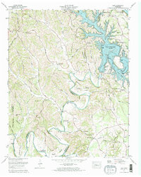
1972 Map of Lois
USGS Topo · Published 1973About this map
The Tims Ford Lake reservoir dominates the eastern landscape of this 1972 survey, its jagged shoreline created by the recently completed Tims Ford Dam. This Tennessee Valley Authority project transformed the upper reaches of the Elk River, flooding former creek bottoms and reorienting local geography around the new waterline. Despite these changes, the upland ridges maintain their traditional character, defined by family-named landmarks and rural hubs like Lois and Brownington.
Find a feature on this map
96 named features on this map. Tap any name to fly to it.
Don’t see what you’re looking for? This feature index may not catch every label — zoom into the map to look around manually.
Map Details
Editions of this 1972 Lois Map
2 editions found
Other maps of this area

1928 · Decherd
USGS Topo · 1:62,500

1936 · Booneville
USGS Topo · 1:24,000

1936 · Flintville
USGS Topo · 1:24,000

1936 · Cumberland Springs
USGS Topo · 1:24,000

1936 · Beans Creek
USGS Topo · 1:24,000

1936 · Huntland
USGS Topo · 1:24,000

1936 · Belvidere
USGS Topo · 1:24,000

1936 · Mulberry
USGS Topo · 1:24,000

1936 · Camp Peay
USGS Topo · 1:24,000

1936 · Lois
USGS Topo · 1:24,000