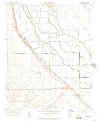
1954 Map of Lokern
USGS Topo · Published 1957About this map
Hydraulic engineering and industrial transit define this portion of the San Joaquin Valley, where the Southern Pacific railroad meets a complex network of irrigation and drainage infrastructure. Water management is central to the landscape, evidenced by the West Side Flood Canal and numerous family-named waterways like Belridge Ditch and Angelo Ditch. These systems support the surrounding agriculture and the local energy sector, anchored by the Lokern Pumping Sta and various oil tanks.
Find a feature on this map
40 named features on this map. Tap any name to fly to it.
Don’t see what you’re looking for? This feature index may not catch every label — zoom into the map to look around manually.
Map Details
Editions of this 1954 Lokern Map
3 editions found
Other maps of this area

1910 · Buena Vista Lake
USGS Topo · 1:125,000

1912 · McKittrick
USGS Topo · 1:125,000

1912 · Buena Vista Lake
USGS Topo · 1:125,000

1914 · Lost Hills
USGS Topo · 1:125,000

1927 · Semitropic
USGS Topo · 1:31,680

1930 · Leonards
USGS Topo · 1:31,680

1931 · Lokern
USGS Topo · 1:31,680

1931 · Goose Lake
USGS Topo · 1:31,680

1932 · West Elk Hills
USGS Topo · 1:31,680

1932 · East Elk Hills
USGS Topo · 1:31,680