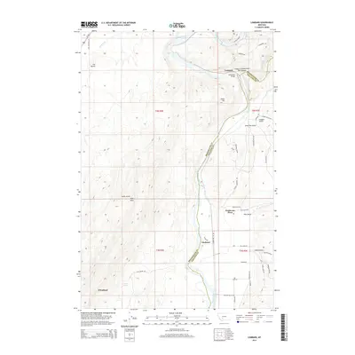
2014 Map of Lombard
USGS Topo · Published 2014About this map
The Missouri River carves a deep path through the boundary of Broadwater and Gallatin counties, where the high plains transition into steep draws and canyons. At the northern bend, the historic site of Lombard marks the junction where the Sixteenmile Cr meets the river, a location once vital for the northern transcontinental railroad routes. The Milwaukee Bridge stands as a clear marker of this transportation legacy, spanning the water just downstream from the Lombard Sixteenmile Hill Canyon.
Find a feature on this map
48 named features on this map. Tap any name to fly to it.
Don’t see what you’re looking for? This feature index may not catch every label — zoom into the map to look around manually.
Map Details
Editions of this 2014 Lombard Map
This is the sole edition of this map. No revisions or reprints were ever made.
Other maps of this area

1886 · Fort Logan
USGS Topo · 1:250,000

1888 · Three Forks
USGS Topo · 1:250,000

1894 · Three Forks
USGS Topo · 1:250,000

1895 · Three Forks
USGS Topo · 1:250,000

1947 · Bozeman
USGS Topo · 1:250,000

1948 · Bozeman
USGS Topo · 1:250,000

1948 · White Sulphur Springs
USGS Topo · 1:250,000

1949 · Radersburg
USGS Topo · 1:62,500

1949 · Manhattan
USGS Topo · 1:62,500

1949 · Toston
USGS Topo · 1:62,500