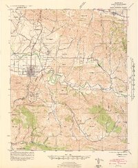
1942 Map of Lompoc
USGS Topo · Published 1942About this map
The Mission La Purisima historic grounds and a nearby CCC Camp define the cultural landscape of this Santa Barbara County region in the early 1940s. Centered on the grid of Lompoc, the map follows the winding course of the Santa Ynez River as it cuts through the Santa Rita Hills toward the coast. Significant land grants including Mission Vieja de la Purisima and Canada de Salsipuedes mark the legacy of Spanish and Mexican rancho boundaries that still dictated land use during this era.
Find a feature on this map
49 named features on this map. Tap any name to fly to it.
Don’t see what you’re looking for? This feature index may not catch every label — zoom into the map to look around manually.
Map Details
Editions of this 1942 Lompoc Map
2 editions found
Other maps of this area

1905 · Guadalupe
USGS Topo · 1:125,000

1905 · Lompoc
USGS Topo · 1:125,000

1942 · Point Arguello
USGS Topo · 1:62,500

1942 · Guadalupe
USGS Topo · 1:125,000

1942 · Lompoc
USGS Topo · 1:125,000

1942 · Lompoc
USGS Topo · 1:62,500

1942 · Pt. Conception
USGS Topo · 1:62,500

1942 · Santa Maria
USGS Topo · 1:62,500

1942 · Gaviota
USGS Topo · 1:62,500

1942 · Point Sal
USGS Topo · 1:62,500