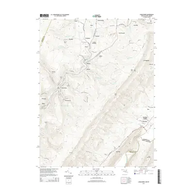
2014 Map of Lonaconing
USGS Topo · Published 2014About this map
Lonaconing and its surrounding coal-country settlements define this portion of the Georges Creek Valley during the early 21st century. The map shows a dense concentration of small communities like Borden Shaft, Ocean, Midland, and Gilmore that grew along the course of Georges Creek. These towns are interconnected by a network of local roads including Old Legislative Rd SW and New Georges Creek Rd SW, reflecting the area's industrial past. Numerous family and community burial grounds, such as Oak Hill Cem, Saint Marys Cem, and Warner Cem, are scattered across the high terrain of Dans Mtn and Jackson Mtn. The landscape is further characterized by essential water infrastructure like the Midland-Gilmore Reservoir and Lonaconing Reservoir, which support these valley settlements tucked between the steep ridges of the Maryland and West Virginia borderlands.
Find a feature on this map
101 named features on this map. Tap any name to fly to it.
Don’t see what you’re looking for? This feature index may not catch every label — zoom into the map to look around manually.
Map Details
Editions of this 2014 Lonaconing Map
This is the sole edition of this map. No revisions or reprints were ever made.
Other maps of this area

1891 · Romney
USGS Topo · 1:125,000

1895 · Piedmont
USGS Topo · 1:125,000

1898 · Frostburg
USGS Topo · 1:62,500

1899 · Grantsville
USGS Topo · 1:62,500

1901 · Frostburg
USGS Topo · 1:62,500

1904 · Grantsville
USGS Topo · 1:62,500

1908 · Frostburg
USGS Topo · 1:62,500

1919 · Elk Garden
USGS Topo · 1:48,000

1920 · Elk Garden
USGS Topo · 1:48,000

1920 · Keyser
USGS Topo · 1:62,500