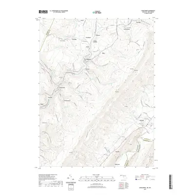
2019 Map of Lonaconing
USGS Topo · Published 2019About this map
Lonaconing and the surrounding coal-country settlements of the Georges Creek valley are defined by a dense network of mountain ridges and creek-carved hollows. In this part of western Maryland, the landscape reflects a heritage of extraction and upland settlement, where communities like Midland, Gilmore, and Ocean cling to the steep topography. Significant elevation changes are marked by landmarks such as Dans Rock and Wolf Rock on the high ridge of Dans Mtn, while the valley floor is punctuated by small villages and historic burial grounds like Saint Marys Cem and Old Coney Cem. The water management infrastructure of the era is evident in the Midland-Gilmore Reservoir and Lonaconing Reservoir, which sit tucked into the hillsides. These geographic features, along with the numerous mountain runs like Squirrel Neck Run and Elklick Run, illustrate the complex drainage patterns that shaped the industrial and residential development of Allegany County.
Find a feature on this map
114 named features on this map. Tap any name to fly to it.
Don’t see what you’re looking for? This feature index may not catch every label — zoom into the map to look around manually.
Map Details
Editions of this 2019 Lonaconing Map
This is the sole edition of this map. No revisions or reprints were ever made.
Other maps of this area

1891 · Romney
USGS Topo · 1:125,000

1895 · Piedmont
USGS Topo · 1:125,000

1898 · Frostburg
USGS Topo · 1:62,500

1899 · Grantsville
USGS Topo · 1:62,500

1901 · Frostburg
USGS Topo · 1:62,500

1904 · Grantsville
USGS Topo · 1:62,500

1908 · Frostburg
USGS Topo · 1:62,500

1919 · Elk Garden
USGS Topo · 1:48,000

1920 · Elk Garden
USGS Topo · 1:48,000

1920 · Keyser
USGS Topo · 1:62,500