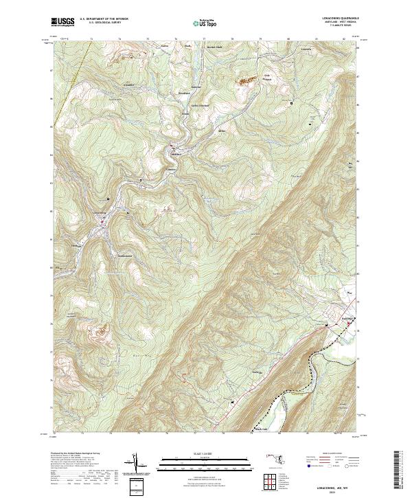
2023 Map of Lonaconing
USGS Topo · Published 2023About this map
Georges Creek carves through this corner of the Appalachian Highlands, where the legacy of industrial mining and mountain settlement is etched into the landscape. Small communities like Borden Shaft, Ocean, and Carlos Junction follow the narrow valley floors and coal-bearing slopes, connected by the CSX Transportation line. These towns, along with Lonaconing and Midland, represent the dense residential clusters formed around the region’s historic resource extraction economy.
Find a feature on this map
116 named features on this map. Tap any name to fly to it.
Don’t see what you’re looking for? This feature index may not catch every label — zoom into the map to look around manually.
Map Details
Editions of this 2023 Lonaconing Map
This is the sole edition of this map. No revisions or reprints were ever made.
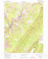
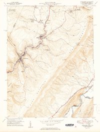
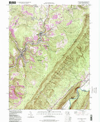
Historical Maps of Rawlings Heights Through Time
4 maps found