
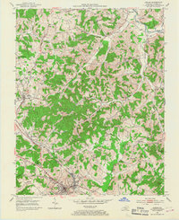
1952 Map of London
USGS Topo · Published 1954About this map
London serves as the focal point of this 1950s Laurel County landscape, where the campus of Sue Bennett College and the State Sanatorium sit amidst a growing regional hub. The geography is defined by the Louisville and Nashville railroad corridor, which links the industrial activities of Pittsburg and East Bernstadt to the broader Kentucky network. A heavy concentration of Strip Mines marks the hillsides, particularly between Wood Creek and Hazel Patch Creek, illustrating the era's intensive resource extraction.
Find a feature on this map
60 named features on this map. Tap any name to fly to it.
Don’t see what you’re looking for? This feature index may not catch every label — zoom into the map to look around manually.
Map Details
Editions of this 1952 London Map
2 editions found
Other maps of this area

1891 · Manchester
USGS Topo · 1:125,000

1893 · London
USGS Topo · 1:125,000

1897 · London
USGS Topo · 1:125,000

1952 · Portersburg
USGS Topo · 1:24,000

1952 · Blackwater
USGS Topo · 1:24,000

1952 · Lily
USGS Topo · 1:24,000

1952 · London SW
USGS Topo · 1:24,000

1952 · Bernstadt
USGS Topo · 1:24,000

1953 · Livingston
USGS Topo · 1:24,000

1953 · Tyner
USGS Topo · 1:24,000