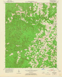
1952 Map of London SW
USGS Topo · Published 1965About this map
The Cumberland National Forest dominates this section of Laurel County, where a dense network of branches and creeks has shaped a landscape of narrow ridges and hollows. During the early 1950s, rural life here centered around small community hubs such as Keavy, defined by proximity to neighborhood institutions like Whitson Sch, Oak Ridge Sch, and McDaniel Chapel. Higher elevations offered strategic advantages for forest management, evidenced by the Bald Rock Lookout Tower and the Hightop terrain.
Find a feature on this map
59 named features on this map. Tap any name to fly to it.
Don’t see what you’re looking for? This feature index may not catch every label — zoom into the map to look around manually.
Map Details
Editions of this 1952 London SW Map
2 editions found
Other maps of this area

1890 · Williamsburg
USGS Topo · 1:125,000

1893 · London
USGS Topo · 1:125,000

1894 · Williamsburg
USGS Topo · 1:125,000

1897 · London
USGS Topo · 1:125,000

1952 · Corbin
USGS Topo · 1:24,000

1952 · Lily
USGS Topo · 1:24,000

1952 · London SW
USGS Topo · 1:24,000

1952 · Vox
USGS Topo · 1:24,000

1952 · Billows
USGS Topo · 1:24,000

1952 · Ano
USGS Topo · 1:24,000