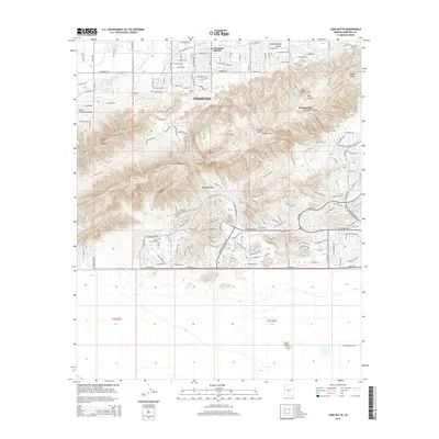
2014 Map of Lone Butte
USGS Topo · Published 2014About this map
The South Mountains dominate this 2014 survey of the southern reaches of Phoenix, where the urban grid meets a complex of protected peaks. The map reveals the stark transition between developed residential neighborhoods such as La Montana del Sur and the protected mountain parkland featuring the Gila Range, Ma Ha Tuak Range, and the Guadalupe Range. This era of the city's growth is marked by a sophisticated network of canals for water management, including the Western Canal and N Highline Lateral Canal, which border the northern flats. Hikers and local historians can trace the established trail systems of the early 21st century, from the Holbert Trail to the Desert Classic, passing through landmarks like Telegraph Pass and climbing toward Mt Suappoa. To the south, the terrain opens into the Gila River Indian Reservation area, anchored by the isolated prominence of Lone Butte.
Find a feature on this map
131 named features on this map. Tap any name to fly to it.
Don’t see what you’re looking for? This feature index may not catch every label — zoom into the map to look around manually.
Map Details
Editions of this 2014 Lone Butte Map
This is the sole edition of this map. No revisions or reprints were ever made.
Other maps of this area

1912 · Phoenix
USGS Topo · 1:62,500

1913 · Mesa
USGS Topo · 1:62,500

1913 · Maricopa
USGS Topo · 1:62,500

1914 · Gila Butte
USGS Topo · 1:62,500

1914 · Phoenix
USGS Topo · 1:62,500

1915 · Mesa
USGS Topo · 1:62,500

1915 · Maricopa
USGS Topo · 1:62,500

1917 · Gila Butte
USGS Topo · 1:62,500

1952 · Tempe
USGS Topo · 1:24,000

1952 · Gila Butte NW
USGS Topo · 1:24,000