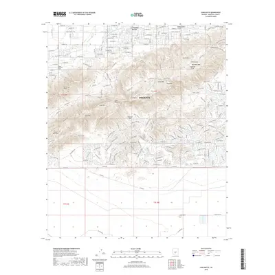
2018 Map of Lone Butte
USGS Topo · Published 2018About this map
South Mountains dominate this landscape, forming a dramatic natural barrier between the expanding residential corridors of Phoenix and the tribal lands to the south. This 2018 survey details the intricate trail network winding through the peaks, including the National Trail, and landmarks such as Mt Suappoa and the Chinese Wall. The contrast between high-density suburban development and protected land is stark, particularly near the Hangar Haciendas Airport and the neighborhood of La Montana del Sur.
Find a feature on this map
173 named features on this map. Tap any name to fly to it.
Don’t see what you’re looking for? This feature index may not catch every label — zoom into the map to look around manually.
Map Details
Editions of this 2018 Lone Butte Map
This is the sole edition of this map. No revisions or reprints were ever made.
Other maps of this area

1912 · Phoenix
USGS Topo · 1:62,500

1913 · Mesa
USGS Topo · 1:62,500

1913 · Maricopa
USGS Topo · 1:62,500

1914 · Gila Butte
USGS Topo · 1:62,500

1914 · Phoenix
USGS Topo · 1:62,500

1915 · Mesa
USGS Topo · 1:62,500

1915 · Maricopa
USGS Topo · 1:62,500

1917 · Gila Butte
USGS Topo · 1:62,500

1952 · Tempe
USGS Topo · 1:24,000

1952 · Gila Butte NW
USGS Topo · 1:24,000