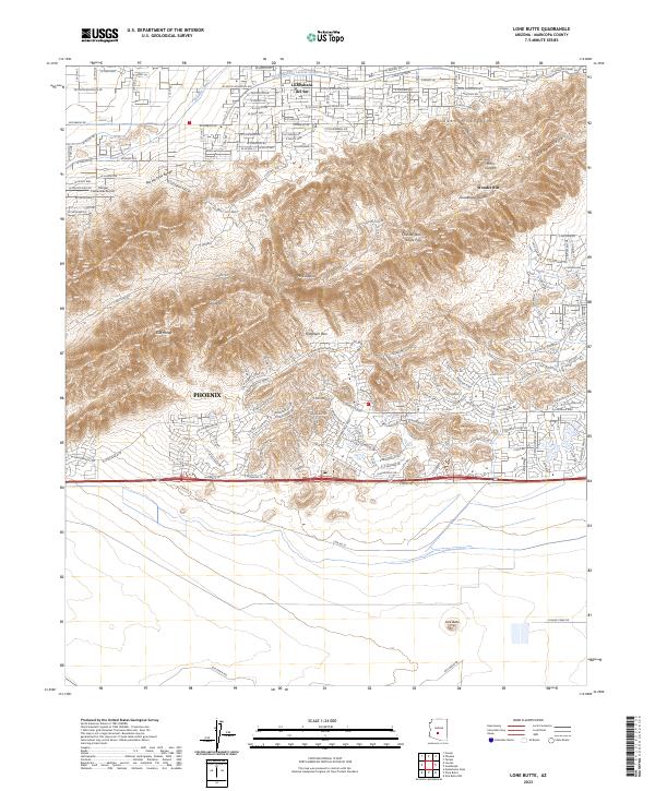
2023 Map of Lone Butte
USGS Topo · Published 2023About this map
Phoenix S Mtn Park dominates this modern topographical landscape, preserving a massive desert mountain environment amidst the expansion of southern Phoenix. The terrain is characterized by complex geological features including the South Mountains, Mt Suappoa, and the Guadalupe Range. The map illustrates the contrast between the protected wilderness of Chinese Wall and Eagle Pass and the encroaching residential developments of La Montana del Sur. Significant water infrastructure is visible through the Highline Canal and Western Canal, which have historically facilitated growth in this arid region. The southern portion of the map transitions into the Gila River Indian Community, anchored by the isolated landmark of Lone Butte and the Gila Range, marking a distinct shift from suburban grid patterns to more open, managed lands.
Find a feature on this map
101 named features on this map. Tap any name to fly to it.
Don’t see what you’re looking for? This feature index may not catch every label — zoom into the map to look around manually.
Map Details
Editions of this 2023 Lone Butte Map
This is the sole edition of this map. No revisions or reprints were ever made.
Other maps of this area

1912 · Phoenix
USGS Topo · 1:62,500

1913 · Mesa
USGS Topo · 1:62,500

1913 · Maricopa
USGS Topo · 1:62,500

1914 · Gila Butte
USGS Topo · 1:62,500

1914 · Phoenix
USGS Topo · 1:62,500

1915 · Mesa
USGS Topo · 1:62,500

1915 · Maricopa
USGS Topo · 1:62,500

1917 · Gila Butte
USGS Topo · 1:62,500

1952 · Tempe
USGS Topo · 1:24,000

1952 · Gila Butte NW
USGS Topo · 1:24,000