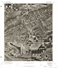
1971 Map of Lone Butte
USGS Topo · Published 1972About this map
South Mountain dominates the landscape of this 1971 orthophotoquad, its rocky ridges and deep desert canyons captured through high-altitude aerial photography. The terrain transitions sharply from the rugged slopes of the mountain to the industrial and agricultural developments of the Salt River Valley below. A significant portion of the lower elevations is occupied by the Phoenix Proving Grounds, where a complex network of test tracks and circular courses is visible against the desert floor. To the south, the namesake Lone Butte stands as a distinct landmark amidst the patterned fields and irrigation canals. This orthophoto edition provides a precise visual record of the desert's edge before significant residential expansion, highlighting the contrast between the natural geography of the range and the structured land use of the proving grounds and surrounding farms.
Find a feature on this map
3 named features on this map. Tap any name to fly to it.
Don’t see what you’re looking for? This feature index may not catch every label — zoom into the map to look around manually.
Map Details
Editions of this 1971 Lone Butte Map
This is the sole edition of this map. No revisions or reprints were ever made.
Other maps of this area

1912 · Phoenix
USGS Topo · 1:62,500

1913 · Mesa
USGS Topo · 1:62,500

1913 · Maricopa
USGS Topo · 1:62,500

1914 · Gila Butte
USGS Topo · 1:62,500

1914 · Phoenix
USGS Topo · 1:62,500

1915 · Mesa
USGS Topo · 1:62,500

1915 · Maricopa
USGS Topo · 1:62,500

1917 · Gila Butte
USGS Topo · 1:62,500

1952 · Tempe
USGS Topo · 1:24,000

1952 · Gila Butte NW
USGS Topo · 1:24,000