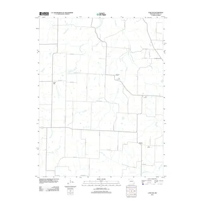
2011 Map of Lone Elm
USGS Topo · Published 2011About this map
Lone Elm and Pisgah serve as the primary nodes of settlement in this rural landscape within Cooper County, Missouri. The area is defined by a dendritic network of streams, notably Clark Fork and its tributaries, including the West Branch Clark Fork and Panther Creek. These waterways historically dictated the placement of homesteads and small family burial grounds that dot the countryside today.
Find a feature on this map
43 named features on this map. Tap any name to fly to it.
Don’t see what you’re looking for? This feature index may not catch every label — zoom into the map to look around manually.
Map Details
Editions of this 2011 Lone Elm Map
This is the sole edition of this map. No revisions or reprints were ever made.
Other maps of this area

1888 · Boonville
USGS Topo · 1:125,000

1947 · Jefferson City
USGS Topo · 1:250,000

1952 · Rocheport
USGS Topo · 1:24,000

1952 · Boonville
USGS Topo · 1:24,000

1952 · Tipton
USGS Topo · 1:24,000
1952 · Clarksburg
USGS Topo · 1:24,000
1952 · Prairie Home
USGS Topo · 1:24,000
1952 · California North
USGS Topo · 1:24,000

1952 · Lone Elm
USGS Topo · 1:24,000

1953 · Billingsville
USGS Topo · 1:24,000