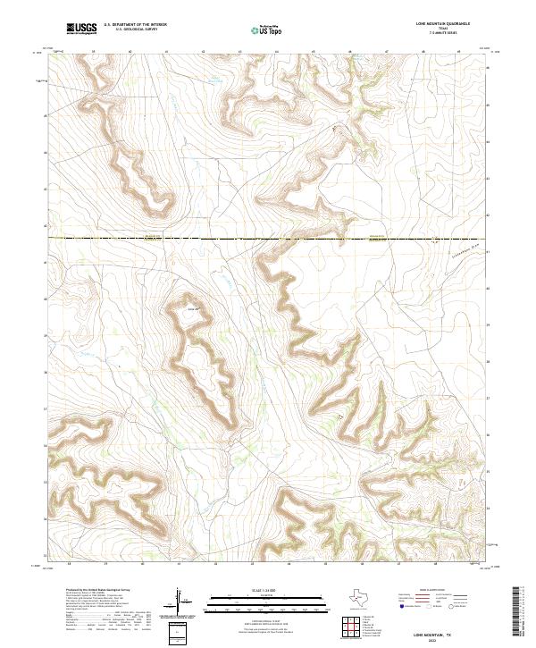
2022 Map of Lone Mountain
USGS Topo · Published 2022About this map
The divide between Reagan and Crockett counties defines this western Texas landscape, where the high plateau gives way to a network of winding draws and creek beds. The namesake Lone Mtn stands as a prominent landmark in a region shaped by intermittent water sources and ranching infrastructure. Arid drainage systems like Noelke Cr and Live Oak Cr carve through the limestone terrain, while man-made features such as Sugar Bowl Tank highlight the necessity of water management in this environment. In the northeastern corner, Grierson Springs provides a rare point of historical interest, marking a site that has long served as a vital water stop in an otherwise dry expanse. The map illustrates the sparse road network typical of the Edwards Plateau, centered around local routes like Co RD 208.
Find a feature on this map
9 named features on this map. Tap any name to fly to it.
Don’t see what you’re looking for? This feature index may not catch every label — zoom into the map to look around manually.
Map Details
Editions of this 2022 Lone Mountain Map
This is the sole edition of this map. No revisions or reprints were ever made.
Other maps of this area

1928 · Rankin
USGS Topo · 1:125,000

1929 · Sheffield
USGS Topo · 1:125,000

1954 · Sonora
USGS Topo · 1:250,000

1954 · San Angelo
USGS Topo · 1:250,000

1958 · Sonora
USGS Topo · 1:250,000

1958 · San Angelo
USGS Topo · 1:250,000

1965 · San Angelo
USGS Topo · 1:250,000

1967 · Owens Creek NE
USGS Topo · 1:24,000

1967 · Twelvemile Camp
USGS Topo · 1:24,000
1967 · Owens Creek NW
USGS Topo · 1:24,000