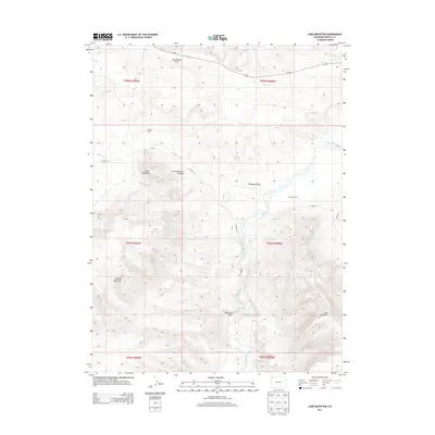
2013 Map of Lone Mountain
USGS Topo · Published 2013About this map
The Little Snake River meanders through this portion of Moffat County, carving a path through a high-desert landscape defined by prominent uplifted landforms. Landmarks like Lone Mountain and its adjacent Lone Mountain Canyon dominate the central terrain, while the massive shoulders of Douglas Mountain and Cross Mountain rise in the south. The distribution of remote outposts such as Tisdell Ranch and Sheridan Ranch suggests a land primarily used for wide-range livestock grazing, where water is the most precious resource.
Find a feature on this map
22 named features on this map. Tap any name to fly to it.
Don’t see what you’re looking for? This feature index may not catch every label — zoom into the map to look around manually.
Map Details
Editions of this 2013 Lone Mountain Map
This is the sole edition of this map. No revisions or reprints were ever made.
Other maps of this area

1907 · Rangely
USGS Topo · 1:125,000

1907 · White River
USGS Topo · 1:125,000

1910 · White River
USGS Topo · 1:125,000

1910 · Rangely
USGS Topo · 1:125,000

1954 · Vernal
USGS Topo · 1:250,000

1958 · Vernal
USGS Topo · 1:250,000

1960 · Vernal
USGS Topo · 1:250,000

1960 · Elk Springs
USGS Topo · 1:62,500

1960 · Lone Mountain
USGS Topo · 1:62,500

1962 · Indian Water Canyon
USGS Topo · 1:24,000