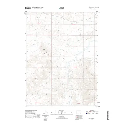
2019 Map of Lone Mountain
USGS Topo · Published 2019About this map
The Little Snake River carves through this corner of Moffat County, defining a high desert landscape marked by dramatic geological formations. Significant elevations such as Douglas Mountain, Lone Mtn, and the edge of Cross Mtn dominate the terrain, separated by deep drainages like Lone Mountain Canyon and Wild Cow Draw. This 2019 survey documents a sparsely populated region where infrastructure is limited to rural routes like Co RD 10 and Co RD 25. The placement of Thompson Springs suggests a vital water source in an otherwise arid environment, while the network of draws, including East Boone Draw and Thompson Draw, illustrates the complex hydrologic pattern of the river basin. The map serves as a contemporary record of this high-plateau cattle country and its topographic landmarks.
Find a feature on this map
21 named features on this map. Tap any name to fly to it.
Don’t see what you’re looking for? This feature index may not catch every label — zoom into the map to look around manually.
Map Details
Editions of this 2019 Lone Mountain Map
This is the sole edition of this map. No revisions or reprints were ever made.
Other maps of this area

1907 · Rangely
USGS Topo · 1:125,000

1907 · White River
USGS Topo · 1:125,000

1910 · White River
USGS Topo · 1:125,000

1910 · Rangely
USGS Topo · 1:125,000

1954 · Vernal
USGS Topo · 1:250,000

1958 · Vernal
USGS Topo · 1:250,000

1960 · Vernal
USGS Topo · 1:250,000

1960 · Elk Springs
USGS Topo · 1:62,500

1960 · Lone Mountain
USGS Topo · 1:62,500

1962 · Indian Water Canyon
USGS Topo · 1:24,000