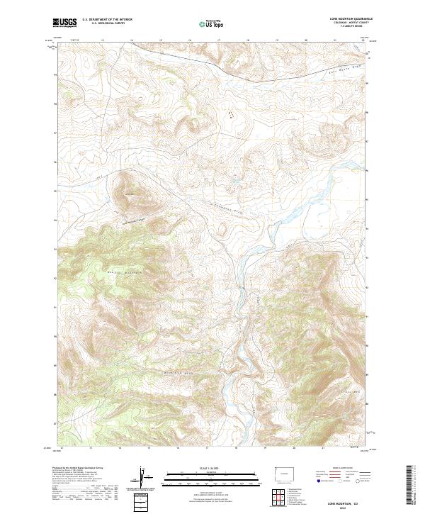
2022 Map of Lone Mountain
USGS Topo · Published 2022About this map
The Little Snake River carves a winding path through this corner of Moffat County, defining a landscape of dramatic elevation changes and named drainages. To the west, the topographic prominence of Lone Mtn and the steep walls of Lone Mountain Canyon dominate the terrain, transitioning southward into the broad heights of Douglas Mountain. This area represents a critical corridor for water and travel in an arid environment, evidenced by the convergence of ephemeral watercourses like East Boone Draw, Thompson Draw, and Wild Cow Draw. Settlement is sparse, with human activity primarily marked by the presence of Highway 318 in the north and a network of county roads such as Co RD 10 and Co RD 153. In the southeast, the terrain rises sharply again toward the slopes of Cross Mtn, while Thompson Springs provides a rare named water source in the central draws.
Find a feature on this map
21 named features on this map. Tap any name to fly to it.
Don’t see what you’re looking for? This feature index may not catch every label — zoom into the map to look around manually.
Map Details
Editions of this 2022 Lone Mountain Map
This is the sole edition of this map. No revisions or reprints were ever made.
Other maps of this area

1907 · Rangely
USGS Topo · 1:125,000

1907 · White River
USGS Topo · 1:125,000

1910 · White River
USGS Topo · 1:125,000

1910 · Rangely
USGS Topo · 1:125,000

1954 · Vernal
USGS Topo · 1:250,000

1958 · Vernal
USGS Topo · 1:250,000

1960 · Vernal
USGS Topo · 1:250,000

1960 · Elk Springs
USGS Topo · 1:62,500

1960 · Lone Mountain
USGS Topo · 1:62,500

1962 · Indian Water Canyon
USGS Topo · 1:24,000