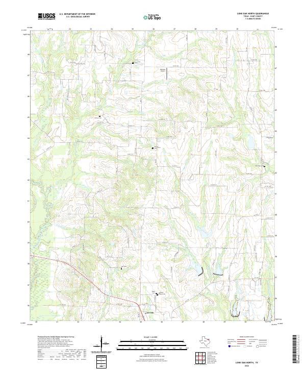
2022 Map of Lone Oak North
USGS Topo · Published 2022About this map
Lone Oak sits at the southern edge of this Hunt County landscape, where the upper reaches of the Sabine River system carve through the terrain. The Cowleech Fork Sabine River and Lake Fork Creek dominate the drainage patterns, creating a network of winding tributaries like Wolf Pen Cr and Pool Br. This modern survey reveals a countryside still largely defined by its rural heritage, anchored by numerous family and community burial grounds such as Williams Chapel Cem and Prairie Valley Cem.
Find a feature on this map
82 named features on this map. Tap any name to fly to it.
Don’t see what you’re looking for? This feature index may not catch every label — zoom into the map to look around manually.
Map Details
Editions of this 2022 Lone Oak North Map
This is the sole edition of this map. No revisions or reprints were ever made.
Other maps of this area

1953 · Texarkana
USGS Topo · 1:250,000

1954 · Dallas
USGS Topo · 1:250,000

1954 · Sherman
USGS Topo · 1:250,000

1956 · Texarkana
USGS Topo · 1:250,000

1956 · Tyler
USGS Topo · 1:250,000

1956 · Quinlan
USGS Topo · 1:62,500

1956 · Emory
USGS Topo · 1:62,500

1958 · Dallas
USGS Topo · 1:250,000

1958 · Sherman
USGS Topo · 1:250,000

1962 · Greenville SE
USGS Topo · 1:24,000