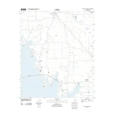
2011 Map of Lone Oak South
USGS Topo · Published 2011About this map
Lake Tawakoni dominates the western landscape of this Northeast Texas region, creating a jagged shoreline defined by points and coves. The 2011 topography captures the interface between the expanding waters and the long-established rural communities of Hunt County. Along the eastern banks, residential clusters like East Tawakoni and Hooker Ridge sit near the water's edge, while the inland town of Lone Oak serves as a northern anchor. Several family and community burial grounds, including McMahan Cemetery and Lynch Cemetery, are preserved among the fields and woodlots. The map details the local infrastructure of the era, from the small Reeder Airport to the crossings at Oak Cove Bridge and Cedar Cove Bridge, illustrating how the local road network adapted to the reservoir's complex geography.
Find a feature on this map
74 named features on this map. Tap any name to fly to it.
Don’t see what you’re looking for? This feature index may not catch every label — zoom into the map to look around manually.
Map Details
Editions of this 2011 Lone Oak South Map
This is the sole edition of this map. No revisions or reprints were ever made.
Other maps of this area

1953 · Texarkana
USGS Topo · 1:250,000

1954 · Dallas
USGS Topo · 1:250,000

1954 · Sherman
USGS Topo · 1:250,000

1956 · Texarkana
USGS Topo · 1:250,000

1956 · Tyler
USGS Topo · 1:250,000

1956 · Quinlan
USGS Topo · 1:62,500

1956 · Emory
USGS Topo · 1:62,500

1958 · Dallas
USGS Topo · 1:250,000

1958 · Sherman
USGS Topo · 1:250,000

1962 · Greenville SE
USGS Topo · 1:24,000