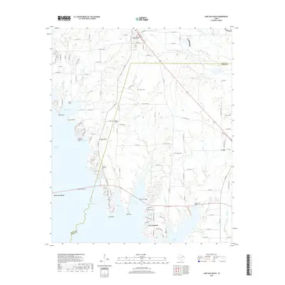
2019 Map of Lone Oak South
USGS Topo · Published 2019About this map
Lake Tawakoni defines the southwestern portion of this landscape at the intersection of Hunt and Rains Counties. The shoreline is punctuated by several geographic points including Cloud Point, Sky Point, and Wind Point, while the residential communities of West Tawakoni and East Tawakoni occupy the irregular peninsulas. To the north, the town of Lone Oak serves as a small hub, situated near the headwaters of Bull Cr and Brickkiln Br.
Find a feature on this map
116 named features on this map. Tap any name to fly to it.
Don’t see what you’re looking for? This feature index may not catch every label — zoom into the map to look around manually.
Map Details
Editions of this 2019 Lone Oak South Map
This is the sole edition of this map. No revisions or reprints were ever made.
Other maps of this area

1953 · Texarkana
USGS Topo · 1:250,000

1954 · Dallas
USGS Topo · 1:250,000

1954 · Sherman
USGS Topo · 1:250,000

1956 · Texarkana
USGS Topo · 1:250,000

1956 · Tyler
USGS Topo · 1:250,000

1956 · Quinlan
USGS Topo · 1:62,500

1956 · Emory
USGS Topo · 1:62,500

1958 · Dallas
USGS Topo · 1:250,000

1958 · Sherman
USGS Topo · 1:250,000

1962 · Greenville SE
USGS Topo · 1:24,000