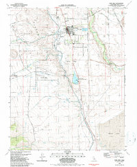
1982 Map of Lone Pine
USGS Topo · Published 1987About this map
Lone Pine serves as the focal point of this Eastern Sierra landscape, situated at the base of the Alabama Hills. The 1980s terrain is marked by a complex water management and transportation infrastructure, featuring the prominent Los Angeles Aqueduct and the Southern Pacific railroad line. To the west, the distinctive rock formations of Movie Flat and the Alabama Hills Recreation Area highlight the region's unique geological character, while the Lone Pine Indian Reservation occupies land immediately south of the town center. Local history is anchored by the Old Lone Pine Cem and Pioneer Cem, while the industrial and agricultural needs of the valley are reflected in various borrow pits and the sewage disposal ponds near the Owens River. Water remains a central theme, from the recreational waters of Diaz Lake to the drainage of Tuttle Creek and Lubken Creek toward the vast, dry bed of Owens Lake.
Find a feature on this map
36 named features on this map. Tap any name to fly to it.
Don’t see what you’re looking for? This feature index may not catch every label — zoom into the map to look around manually.
Map Details
Editions of this 1982 Lone Pine Map
2 editions found
Other maps of this area

1905 · Olancha
USGS Topo · 1:125,000

1907 · Olancha
USGS Topo · 1:125,000

1907 · Mt. Whitney
USGS Topo · 1:125,000

1908 · Ballarat
USGS Topo · 1:250,000

1913 · Ballarat
USGS Topo · 1:250,000

1919 · Mt. Whitney
USGS Topo · 1:125,000

1937 · Mt. Whitney
USGS Topo · 1:125,000

1948 · Death Valley
USGS Topo · 1:250,000

1948 · Fresno
USGS Topo · 1:250,000

1950 · New York Butte
USGS Topo · 1:62,500