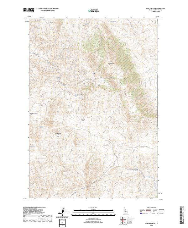
2024 Map of Lone Pine Peak
USGS Topo · Published 2024About this map
Lone Pine Peak stands as the central landmark of this high-elevation region in Custer County, Idaho. The landscape is defined by deep drainages and intermittent water sources, characterized by features like Malm Gulch and the winding Spar Canyon. High-country hydrology is documented through numerous named points of interest, including Lone Pine Spring and the curiously named Jenson Cabin Spring. These springs and seasonal catchments like Red Lake suggest a history of seasonal rangeland use or wilderness navigation.
Find a feature on this map
26 named features on this map. Tap any name to fly to it.
Don’t see what you’re looking for? This feature index may not catch every label — zoom into the map to look around manually.
Map Details
Editions of this 2024 Lone Pine Peak Map
This is the sole edition of this map. No revisions or reprints were ever made.
Other maps of this area

1929 · Bayhorse
USGS Topo · 1:125,000

1957 · Challis
USGS Topo · 1:250,000

1960 · Challis
USGS Topo · 1:250,000

1963 · Challis
USGS Topo · 1:250,000

1963 · Bald Mountain
USGS Topo · 1:24,000

1963 · Bayhorse
USGS Topo · 1:24,000
1963 · Ziegler Basin
USGS Topo · 1:24,000
1963 · Little Antelope Flat
USGS Topo · 1:24,000

1963 · Clayton
USGS Topo · 1:62,500

1963 · Lone Pine Peak
USGS Topo · 1:62,500