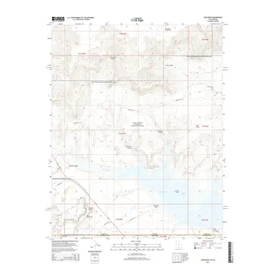
2014 Map of Lone Rock
USGS Topo · Published 2014About this map
Glen Canyon National Recreation Area dominates this desert landscape, spanning the border between Utah and Arizona near the modern shoreline of Lake Powell. This 2014 survey captures the intricate network of canyons and high points that define the area's geology, from the heights of Mustard Point and Stud Horse Point to the recessed depths of Crosby Canyon and Wiregrass Canyon. Water remains the primary shaper of the terrain here, evident in the drainage patterns of Blue Pool Wash and Wahweap Cr as they flow toward Wahweap Bay.
Find a feature on this map
36 named features on this map. Tap any name to fly to it.
Don’t see what you’re looking for? This feature index may not catch every label — zoom into the map to look around manually.
Map Details
Editions of this 2014 Lone Rock Map
This is the sole edition of this map. No revisions or reprints were ever made.
Other maps of this area

1886 · Escalante
USGS Topo · 1:250,000

1886 · Echo Cliffs
USGS Topo · 1:250,000

1891 · Echo Cliffs
USGS Topo · 1:250,000

1922 · Warm Creek
USGS Topo · 1:63,360

1951 · Lees Ferry NE
USGS Topo · 1:24,000

1953 · Nipple Butte
USGS Topo · 1:62,500

1953 · Gunsight Butte
USGS Topo · 1:62,500

1954 · Lees Ferry NW
USGS Topo · 1:24,000

1954 · Leche-E Rock
USGS Topo · 1:62,500

1954 · Lees Ferry
USGS Topo · 1:62,500