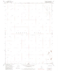
1969 Map of Lone Rock SW
USGS Topo · Published 1985About this map
The Carson Sink Alkali Flat (Depression) dominates this high-desert landscape, reflecting the stark geography of Churchill County as it appeared in the late 1960s. This terminal drainage basin is defined by its extreme isolation and lack of traditional landmarks, serving as a catchment for the region's intermittent waters. In the northeastern portion of the sheet, the presence of the Navy Bombing Area indicates the specialized military utility found for these remote, arid reaches. Scattered Sand Dunes are the only significant relief in an otherwise flat expanse. Mapped by the Geological Survey using aerial photography from 1968, the map illustrates a landscape nearly devoid of permanent human infrastructure or roads, preserved here as a study in Great Basin geology and mid-century military land use.
Find a feature on this map
6 named features on this map. Tap any name to fly to it.
Don’t see what you’re looking for? This feature index may not catch every label — zoom into the map to look around manually.
Map Details
Editions of this 1969 Lone Rock SW Map
2 editions found
Other maps of this area

1908 · Carson Sink
USGS Topo · 1:250,000

1910 · Carson Sink
USGS Topo · 1:250,000

1950 · Stillwater
USGS Topo · 1:62,500

1951 · Carson Sink
USGS Topo · 1:62,500

1957 · Reno
USGS Topo · 1:250,000

1959 · Reno
USGS Topo · 1:250,000

1960 · Reno
USGS Topo · 1:250,000
1969 · Lone Rock SW
USGS Topo · 1:24,000

1969 · Cox Canyon
USGS Topo · 1:24,000

1969 · Pintail Bay
USGS Topo · 1:24,000