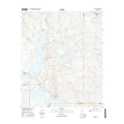
2016 Map of Lone Star
USGS Topo · Published 2016About this map
The industrial and hydraulic landscape of northeast Texas is clearly visible here, where the iron-rich terrain of the Black Mountains gives way to the major water management projects of the mid-20th century. The town of Lone Star serves as a central hub, situated between the large expanse of Ellison Cr Reservoir and Barnes Cr Reservoir. This area reflects the transition from early rural settlements to a landscape shaped by resource extraction and water storage, evidenced by the numerous small family burial grounds like Iron Bluff Cem and South Union Cem that remain adjacent to modern industrial corridors like Industrial Blvd. To the south, the map captures the northern reaches of Lake O' the Pines, a massive reservoir on Big Cypress Cr that redefined the geography of the Morris, Cass, and Marion Co borderlands. High points such as Buzzard Roost Mtn and Fowler Mtn provide the topographical relief that necessitated these complex drainage and catchment systems.
Find a feature on this map
113 named features on this map. Tap any name to fly to it.
Don’t see what you’re looking for? This feature index may not catch every label — zoom into the map to look around manually.
Map Details
Editions of this 2016 Lone Star Map
This is the sole edition of this map. No revisions or reprints were ever made.
Other maps of this area

1914 · Daingerfield
USGS Topo · 1:62,500

1953 · Texarkana
USGS Topo · 1:250,000

1956 · Texarkana
USGS Topo · 1:250,000

1956 · Tyler
USGS Topo · 1:250,000

1960 · Coffeeville
USGS Topo · 1:24,000

1960 · La Fayette
USGS Topo · 1:24,000

1961 · Lassater
USGS Topo · 1:24,000

1962 · Avinger
USGS Topo · 1:24,000

1962 · Ore City
USGS Topo · 1:24,000

1962 · Lone Star
USGS Topo · 1:24,000