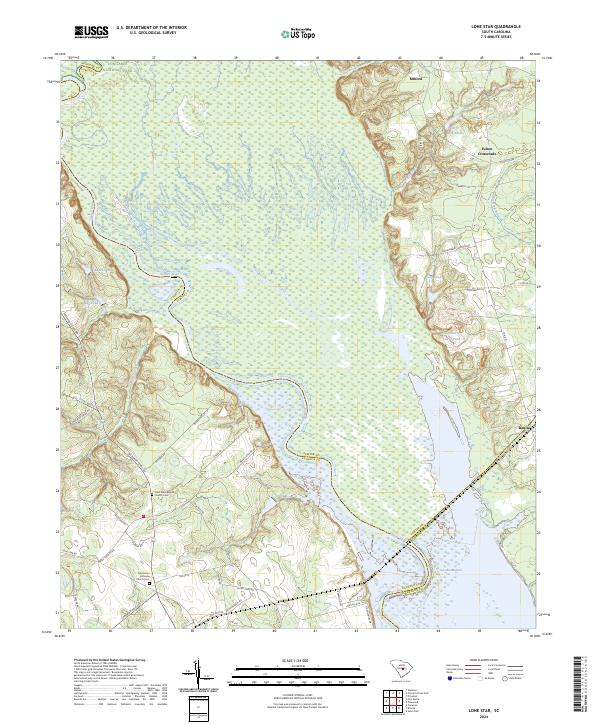
2024 Map of Lone Star
USGS Topo · Published 2024About this map
The Santee River corridor and its surrounding wetlands define this landscape where the boundaries of Richland, Sumter, and Calhoun counties meet. The northwestern corner includes a portion of Congaree National Park, highlighting the preservation of this intricate riverine ecosystem. To the southeast, the expansive waters of Lake Marion begin to dominate the terrain, reflecting the mid-20th-century transformations of the South Carolina lowcountry. Local life is anchored by small settlements and rural junctions like Rimini, Fulton Crossroads, and Milford. For those tracing family history, the map identifies essential landmarks such as Saint Mark Baptist Church Cem and Pine Grove Lutheran Church Cem. The road network, featuring names like McCords Ferry Rd and Packs Landing Rd, points to a long history of river crossings and landings that once served as vital commerce links between the interior and the coast.
Find a feature on this map
50 named features on this map. Tap any name to fly to it.
Don’t see what you’re looking for? This feature index may not catch every label — zoom into the map to look around manually.
Map Details
Editions of this 2024 Lone Star Map
This is the sole edition of this map. No revisions or reprints were ever made.
Other maps of this area

1943 · Eastover
USGS Topo · 1:62,500

1946 · Elloree
USGS Topo · 1:62,500

1946 · Sumter
USGS Topo · 1:62,500

1953 · Poinsett State Park
USGS Topo · 1:24,000

1953 · Wateree
USGS Topo · 1:24,000

1954 · Augusta
USGS Topo · 1:250,000

1957 · Sumter
USGS Topo · 1:62,500

1957 · Augusta
USGS Topo · 1:250,000

1958 · Augusta
USGS Topo · 1:250,000

1961 · Augusta
USGS Topo · 1:250,000