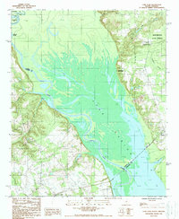
1988 Map of Lone Star
USGS Topo · Published 1988About this map
Lake Marion and the Santee River dominate this landscape at the intersection of Calhoun, Sumter, and Clarendon counties. In the late 1980s, the area illustrates a complex hydrography where the river channel winds through the expansive waters of the lake, punctuated by numerous small islands and marshy inlets like Weeks Landing. The eastern shore is defined by the high ground of the Manchester State Forest, where the terrain rises sharply from the wetlands toward Fulton Crossroads.
Find a feature on this map
26 named features on this map. Tap any name to fly to it.
Don’t see what you’re looking for? This feature index may not catch every label — zoom into the map to look around manually.
Map Details
Editions of this 1988 Lone Star Map
This is the sole edition of this map. No revisions or reprints were ever made.
Other maps of this area

1943 · Eastover
USGS Topo · 1:62,500

1946 · Elloree
USGS Topo · 1:62,500

1946 · Sumter
USGS Topo · 1:62,500

1953 · Poinsett State Park
USGS Topo · 1:24,000

1953 · Wateree
USGS Topo · 1:24,000

1954 · Augusta
USGS Topo · 1:250,000

1957 · Sumter
USGS Topo · 1:62,500

1957 · Augusta
USGS Topo · 1:250,000

1958 · Augusta
USGS Topo · 1:250,000

1961 · Augusta
USGS Topo · 1:250,000