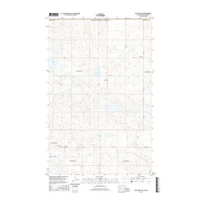
2017 Map of Lone Tree Lake
USGS Topo · Published 2017About this map
Comertown serves as the primary focal point in this portion of Sheridan County, Montana, situated just south of the international border. The landscape is defined by its characteristic prairie potholes and intermittent water bodies, including the namesake Lone Tree Lake, Larson Slough, and Widgeon Slough. This 2017 survey reveals a highly organized township and range grid, with local transit following section lines through roads such as Ueland Rd and McElroy Rd. For those researching local families, the map identifies three distinct burial sites: Comertown Cem, Lone Tree Cem, and Our Saviors Cem. These features, along with the proximity to the Canadian border, illustrate the persistence of small agricultural communities and their essential landmarks in the northern Great Plains.
Find a feature on this map
21 named features on this map. Tap any name to fly to it.
Don’t see what you’re looking for? This feature index may not catch every label — zoom into the map to look around manually.
Map Details
Editions of this 2017 Lone Tree Lake Map
This is the sole edition of this map. No revisions or reprints were ever made.
Other maps of this area

1954 · Wolf Point
USGS Topo · 1:250,000

1958 · Wolf Point
USGS Topo · 1:250,000

1983 · Tadpole Lake
USGS Topo · 1:24,000

1983 · Dooley SE
USGS Topo · 1:24,000

1983 · Lone Tree Lake
USGS Topo · 1:24,000

1983 · Park Lake
USGS Topo · 1:24,000

1983 · Westby South
USGS Topo · 1:24,000

1983 · Westby North
USGS Topo · 1:24,000
2011 · Dooley SE
USGS Topo · 1:24,000
2011 · Lone Tree Lake
USGS Topo · 1:24,000